Geospatial / Remote Sensing
- Google Earth Engine
- Apache Sedona
- Rasterio, Xarray, GeoPandas, Shapely
- QGIS
- Sentinel, Landsat, SAR, GeoFMs
I build geospatial ML pipelines
I design production-focused Earth observation and geospatial AI solutions for scalable remote sensing workflows.
I’m a data scientist and geospatial ML engineer who turns Earth observation data into decisions people can actually use. I specialize in taking EO imagery from raw pixels to production-ready maps, models, and decision tools for agriculture and environmental management. Over the last several years, I’ve shipped work across research and industry: from graduate field campaigns in soil hydrology and salinity mapping, through postdoctoral remote sensing roles at UC Riverside and the USDA Salinity Lab, to production ML systems at Climate LLC (Bayer Crop Science). In those roles I’ve built modular, cloud-based pipelines for crop classification, soil salinity and moisture mapping, and land-use monitoring, with an emphasis on reproducibility, maintainability, and clear model performance. My PhD in Environmental Sciences (Soil & Water, UC Riverside) keeps me grounded in the real-world processes behind the pixels, and I bring that context into every model and workflow.

2018 - 2021
Ph.D., Environmental Sciences (Soil & Water)
2015 - 2017
MS, Plant Science
2011 - 2015
BS, Agriculture
End-to-end pipelines for landcover, biomass, and crop classification from optical/SAR imagery and GeoFM embeddings. Proficient in analyzing satellite imagery across platforms - Google Earth Engine, Descartes Labs, Apache Sedona, and libraries - Rasterio, xarray, GeoPandas, shapely etc.
End-to-end pipelines, experiment tracking, model evaluation, CI/CD, MLflow, model monitoring, versioning.
Computer vision, geospatial AI, multimodal feature engineering, segmentation, time-series modeling, transformers, foundation-model prototyping.
Nov 2023 – Present
Working as a Data Scientist, Remote Sensing. Climate LLC (DFS) is the digital farming arm of Bayer Crop Science.
Nov 2022 – Nov 2023
I worked as a contractor with the Data Insights Geospatial and Remote Sensing team. Responsible for fulfilling requests for geospatial data analysis from various teams and presenting the workflow to stakeholders.
Jan 2022 – Oct 2022
The focus of my work was to study high-resolution soil-plant relationships. A particular focus was on the estimation of soil moisture by combining public and private soil moisture ground measurements, remote sensing, and other datasets with machine learning methods
Jan 2018 – Dec 2021
Dissertation: 'Advancing Urban Landscape Irrigation Management using Smart Controllers and Machine Learning-Based Models'. Worked on a variety of projects related to irrigation and water management using different approaches, such as advanced data acquisition, machine learning, remote sensing, and GIS & GPS technologies. I was responsible for aggregating & statistically analyzing large agricultural datasets using Python, R or MATLAB
Aug 2015 – Dec 2017
Thesis: 'Use of EM-38 soil surveys in forage fields at a saline drainage water reuse site to calibrate a hydro-salinity model for decision support.' I was responsible for conducting soil salinity mapping using electromagnetic sensing platforms and analyzing spatial data.
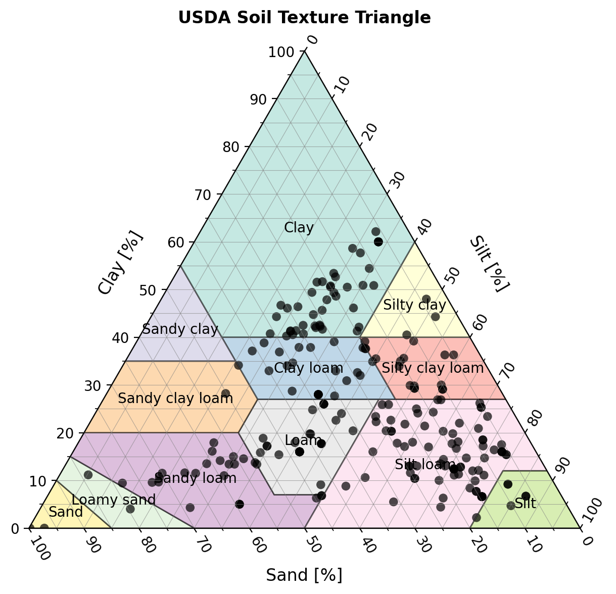
An open-source Python package and companion Streamlit app for classifying and visualizing soil texture data on ternary diagrams. It supports USDA and HYPRES systems, CSV-based wor…
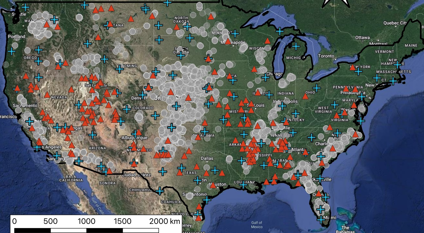
Gaining new insight into the spatiotemporal variability of soil moisture is vital for precision agriculture and efficient irrigation scheduling. Several satellites measure earth s…
The projected rise in the population of Southern California from what is already the highest in the state, calls for new approaches to outdoor urban water conservation that can al…
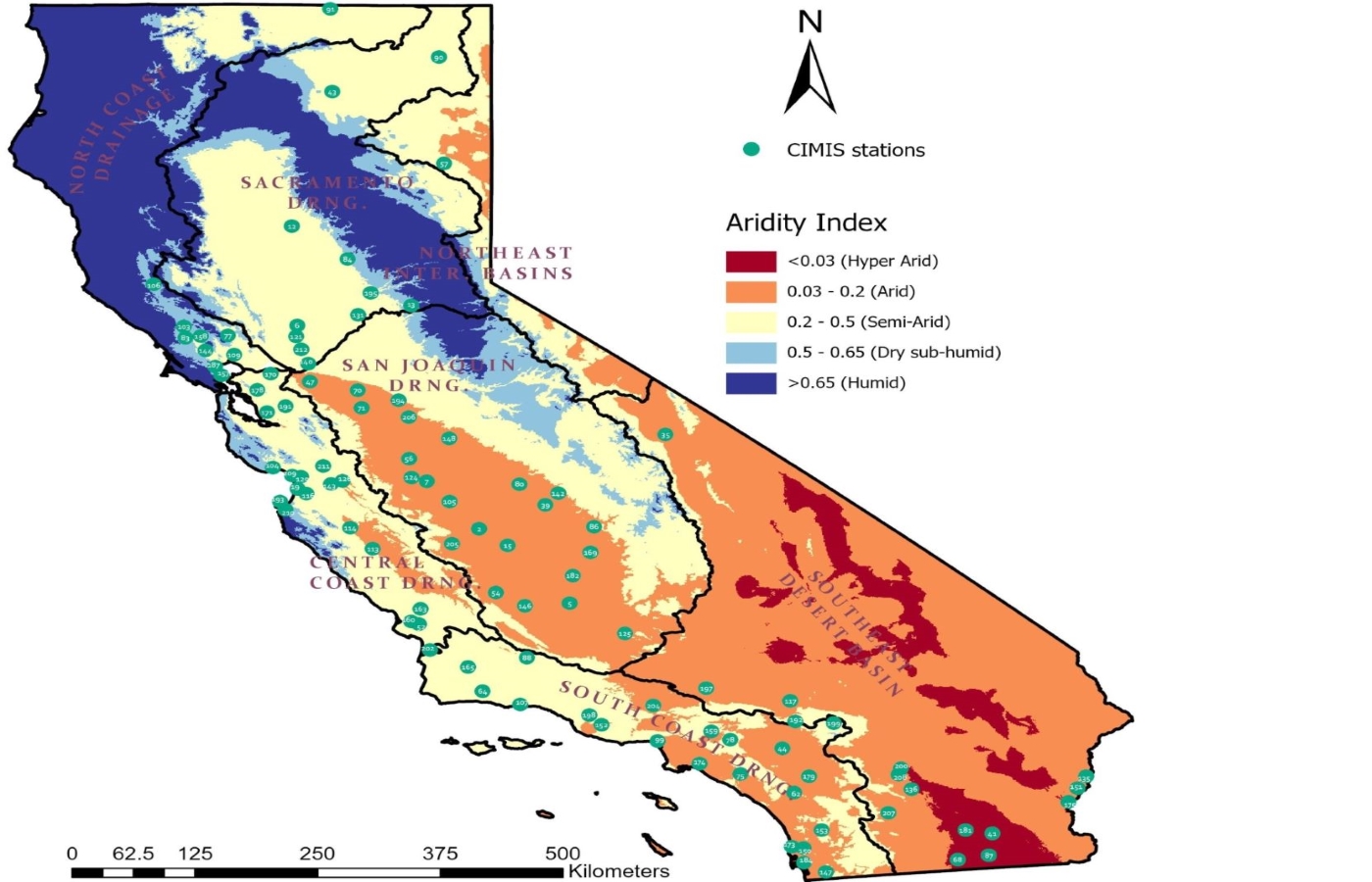
Accurate estimation of reference evapotranspiration (ETo) is crucial for irrigation scheduling and regional water resources management. The FAO-56 Penman-Monteith or the CIMIS Pen…
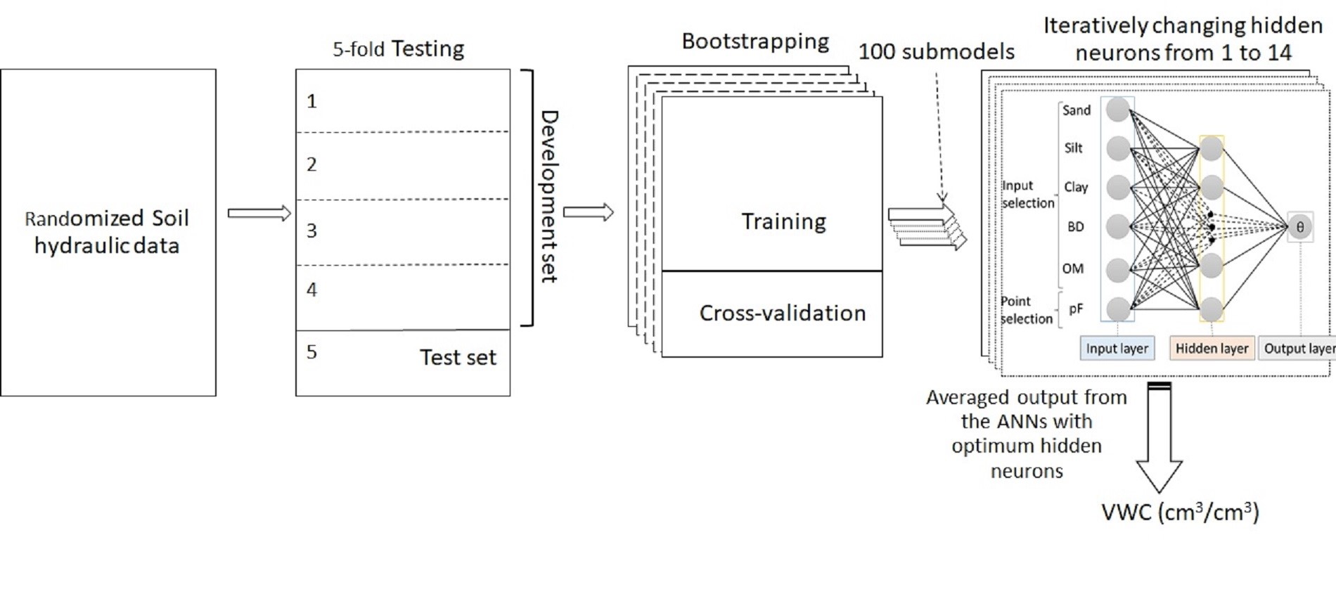
Direct measurements of soil hydraulic properties are time-consuming, challenging, and often expensive. Therefore, their indirect estimation via pedotransfer functions (PTFs) based…
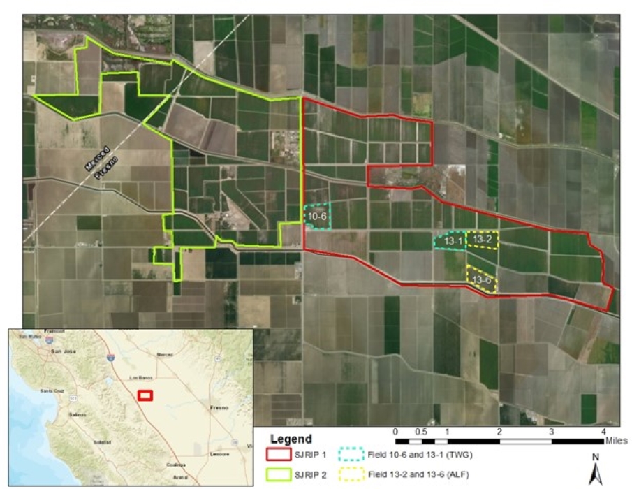
In this study, EM-38 soil salinity surveys were conducted at the SJRIP (San Joaquin River Improvement Project) facility managed by the Panoche Water District (Los Banos, Californi…
Near‐ground microwave radiometry for on‐the‐go surface soil moisture sensing in micro‐irrigated orchards in California (2025) — Agrosystems Geosciences & Environment
Assessing onion salt tolerance using soil apparent electrical conductivity directed soil sampling, planet scope derived yield maps, and boundary analysis (2025) — Agricultural Water Management
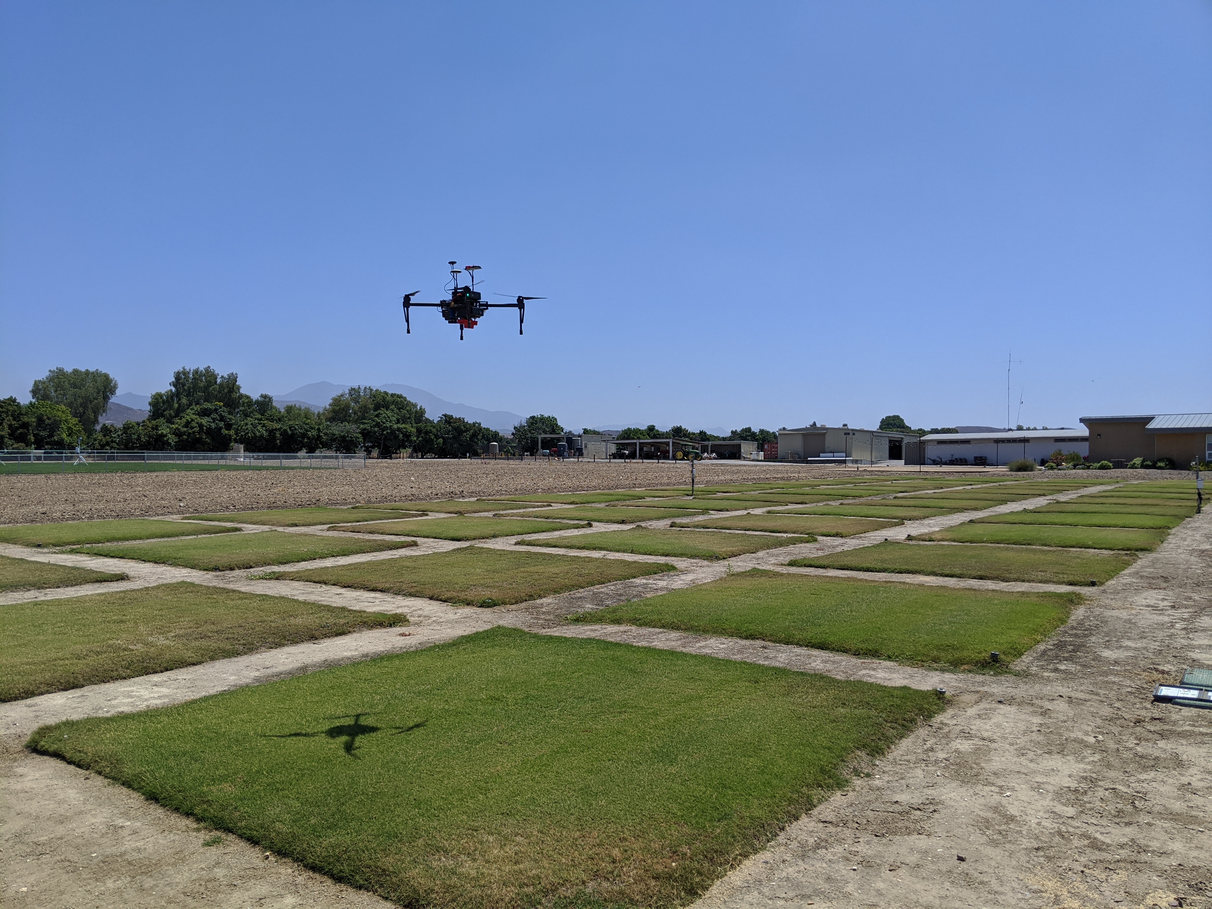
Assessing the Impact of Water Conservation on Cooling Potential of Two Turfgrass Species (2024) — Journal of the ASABE
Using a soil moisture sensor-based smart controller for autonomous irrigation management of hybrid bermudagrass with recycled water in coastal Southern California (2024) — Agricultural Water Management
Estimating the soil water retention curve by the HYPROP-WP4C system, HYPROP-based PCNN-PTF and inverse modeling using HYDRUS-1D (2024) — Journal of Hydrology
Developing Turfgrass Water Response Function and Assessing Visual Quality, Soil Moisture and NDVI Dynamics of Tall Fescue Under Varying Irrigation Scenarios in Inland Southern California (2023) — Journal of the ASABE
Response of Landscape Groundcovers to Deficit Irrigation: An Assessment Based on Normalized Difference Vegetation Index and Visual Quality Rating (2023) — HortScience
Development and evaluation of temperature-based deep learning models to estimate reference evapotranspiration (2023) — Artificial Intelligence in Agriculture
Hybrid Bermudagrass and Tall Fescue Turfgrass Irrigation in Central California: II. Assessment of NDVI, CWSI, and Canopy Temperature Dynamics (2021) — Agronomy